

Gallery
Some working examples of PyWPS in action. Add yourself!
talos-wps
- Published: 2020
- URL: https://github.com/talos-gis/talos_wps
- Author: talos-gis
- Status: in development
Main Functionality: raster processing: clipping, dem coloring, viewshed GDAL based
LycheePy
- Published: 2018
- URL: https://github.com/gabrielbazan/lycheepy
- Author: Gabriel José Bazán
- Status: in development
LycheePy is a distributed processing server which allows the publication of pre-defined processing chains through a WPS interface, implemented with PyWPS. In addition, it provides direct integration with repositories (e.g. GeoServer, FTP servers, or you own integration), allowing the automatic publication of processing results.
pointWPS
- Published: 2017
- URL: http://pointclouds.nci.org.au/
- Author: Dr Adam Steer
- Hosted: NCI - Australia’s National Computational Infrastructure: http://nci.org.au
PyWPS-4 used in OGC Soil Data IE Demonstration - Sydney, Australia - 03 December 2015
- Published: 2015
- URL: https://www.youtube.com/watch?v=kNVfKVhtKJ8&t=38m
Height profile by Norwegian Mapping Authority
- Published: 2014
- URL:
- Details:
- MapFish
- Matplotlib
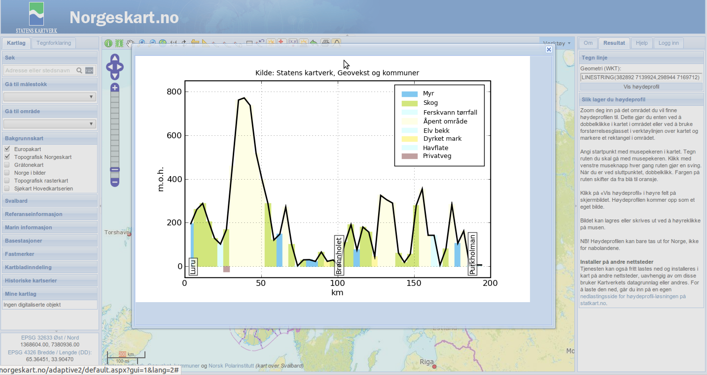
Provided by: Norwegian Mapping Authority / Statens kartverk
Ominiverdi’s demo page
- Integration to ka-Map!
- Buffer, Path, r.drain and other modules in usage
- GRASS GIS
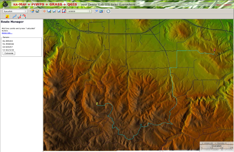
URL: http://pywps.ominiverdi.org
Provided by: Ominiverdi
Analytical server of Czech Forest Management Institute
- Supervised and unsupervised image classification
- Image postprocessing
- Get sample training areas from
- PyWPS and OpenLayers integration
- GRASS GIS
- Sample training areas file: http://apps.humboldt-esdi.cz/klasifikace/training_areas/training_areas_en.gml
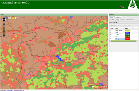
(note: works only on south-eastern part of Czech republic)
URL: http://apps.esdi-humboldt.cz/klasifikace
Provided by: HS-RS
Analytical server of Slovak Environmental Agency
- Visibility analysis
- OpenLayers integration
- GRASS GIS
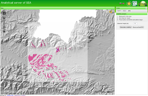
URL: http://geo.sazp.sk
Provided by: HS-RS
INSPIRE Transformation service
- Demonstration implementation of INSPIRE Transformation service according to INSPIRE Draft Transformation Implementing Rule (Version 2.0)
- Uses GML v2.0
- Integration with OpenLayers
- Full source at http://dev.bnhelp.cz/inspire
- GDAL
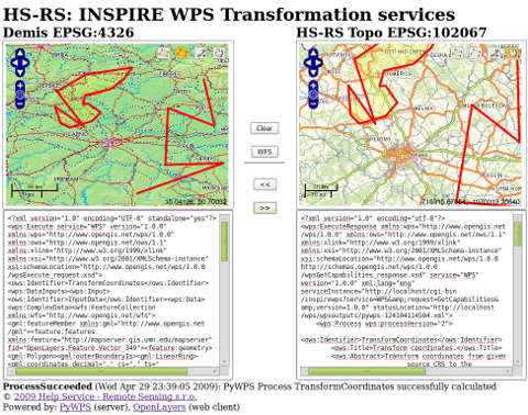
URL: http://dev.bnhelp.cz/inspire/client
Provided by: HS-RS
Google maps API integration
- Google Maps http://maps.google.com
- OpenLayers http://openlayers.org
- GRASS GIS

URL: http://pywps.ominiverdi.org/demo_google.html
Provided by: Ominiverdi
Your Site
Did we forget you? Tell us!